Showing posts with label crossings. Show all posts

Monday, June 30, 2014

When a street is not a road.


My year and a half in Afghanistan working under the US Air Force confronted me with a new acronym almost every day.  One of the bases for which I wrote a comprehensive plan required a “Glossary of Acronyms” in order to sort them all out, ballooning to several pages in length.  It was exhausting.


And then there are the words made up on the spot.


Generally speaking, I leave neologisms to the likes of Buckminster Fuller.  And even though acronyms don’t qualify as newly minted words, they can serve largely the same semantic function.  It’s hard not to scan the cultural forces that help to elicit both acronyms and neologisms with a certain level of amusement.  I’ll admit that I’ve deployed a new word from my artillery from time to time.  (I’d like to think I coined the term “popera” long before it achieved musical relevancy, but no one will see me phoning my lawyer.) Even though the output of fabricated labels within the discipline of urban studies pales in comparison to the Department of Defense, I still find that I’m rarely in the up-and-up when it comes to new trends or the modish terms to describe them.


Which brings us to the stroad.  I wasn’t aware of what a stroad was until just a few months ago.  Semantically, it seems just as inaccurate as the façadectomy that I have referenced a few times in the past.  After all, “stroad” is a portmanteau of “street” and “road”, used to characterize an arterial that seems to share features of both, but also nullifies their intrinsic advantages.  But aren’t “street” and “road” synonymous?  According to a recent City Lab article, Chuck Marohn, a “recovering traffic engineer”, coined the term “stroad” to describe any right-of-way that “moves cars at speeds too slow to get around efficiently but too fast to support productive private sector development”.  Therefore, a stroad tries to achieve the most desirable characteristics of both roads (for their ability to move vehicular traffic quickly) and streets (for their ability to link neighborhood features in an aesthetic manner that remains safe and appealing for all users).  It fails on both counts. According to Marohn, “anytime you are traveling between 30 and 50 miles per hour [as is typically characteristic of a stroad], you are basically in an area that is too slow to be efficient yet too fast to provide a framework for capturing a productive rate of return.”  Marohn has created a video through his nonprofit Strong Towns that offers a visualization of an archetypal stroad. 


My long-repressed English major has turned me into an insufferable semantic nitpicker.  Here I criticize Marohn for placing two words—street and road—into tidy, discrete semantic boxes…two words that for most people are fungible.  Beyond that, I need to chill out, because Marohn’s neologism is effective in pretty much every other sense.  Regardless of whether or not a stroad blends a street and a road, as anyone else would define it, it still feels like a hybrid of two types of right-of-way.  Perhaps it cold be called an arterial and a collector (a “collecterial”?), but then those two terms are fully entrenched in the lingo of transportation engineers.


“Stroad” really conveys another key point.  It’s one ugly sounding word—clipped, aggressive and vulgar.  It almost sounds like a blend of stoat and toad, two largely unloved animals.  And, in my first real-life encounter with a stroad (at least at a point when I knew what the word meant), the first thing that occurred to me was the unattractiveness of the landscape.  Here it is:


I’m looking eastward down Michigan Avenue, in the Great Lake State’s capital of Lansing.  And it’s obvious that this major street, which connects downtown Lansing to the campus of Michigan State University in nearby East Lansing, has enjoyed a number of investments that attempt to make it a more attractive environment for pedestrians.  Notice the vintage lamps hugging the curbs.  Another angle reveals some “bulb out” sidewalk designs intended to lower the section of the street necessary for walkers to cross at a given crosswalk, as seen below:


And, to be fair, quite a few of the structures on the north side of the street (to the left in these photos) date from a time period when most buildings directly addressed the sidewalk.   But the side on which I was standing—the south side—shows the fierce competition that those handsome old two-story buildings must face.


To be fair, real estate speculators have caught on to the notion that this is a redeveloping area, and someone is trying to market this corner parcel to capitalize on what is ostensibly an emerging district for young professionals.


I wish this developer the best of luck.  He or she may very well succeed.  After all, just a half-block to the west, on the north side of the street, sits the Cooley Law School Stadium, an apparent recent addition that has prompted certain civic boosters to brand this stretch of Michigan Avenue as the “Stadium District”.


And on the otherwise desolate south side of the street, another obviously recent mixed-use development sits just a little further to the west, ostensibly capitalizing on the Stadium District name.


And, another block to the west, an old industrial building has benefited from a repurposing into a mixed-use facility with restaurants on the first floor.


Perhaps Michigan Avenue will come together wonderfully as a corridor with densely interwoven different uses.  It doesn’t hurt to be optimistic.  After all, this stroad terminates just a few blocks further to the east, at the Michigan State Capitol. 


The elongated dome of the Capitol is visible in the distance.  So this Stadium District is just a football toss away from Lansing’s downtown and the center of Michigan’s government.  (But, incidentally, not the Ingham County seat.  Lansing is among the only state capitals that is not also the center of government for its respective county.)  But compare Michigan Avenue to another, smaller commercial thoroughfare in central Lansing:


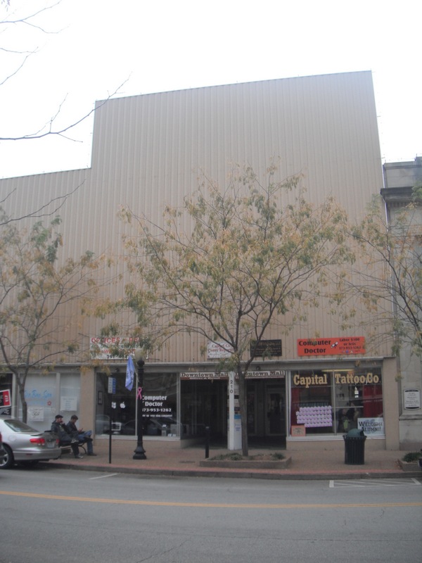
The above pictures reveal the streetscape for Washington Square, a street perpendicular to Michigan Avenue that runs just a block east of the capitol.  Both roads are visible on the map below:


On Washington Square, cars can still get where they need to be, but never while careening at 50 miles per hour.  The abundance of on-street parking—most of it occupied on a lazy Saturday afternoon—integrates peaceably with the copious sidewalk-oriented buildings, resulting in an environment that is far more likely to foster higher concentrations of pedestrians.  Compare once more with Michigan Avenue just a few blocks away:


Churck Marohn recognizes that stroads often boast superlative investment.  But to what end?  The sidewalk on the right looks great, with decorative brick pavers, street trees, and wrought iron gates.  But the gaps between all the buildings on the right suggest that most landowners in this area still prefer setting aside plenty of space for off-street parking. Meanwhile, on the left, abutting the Cooley Law School Stadium, is another big parking lot.


And since parking lots are not exactly a high-intensity land use, chances are the land values along Michigan Avenue are significantly lower than Washington Square.  Admittedly, Washington Square is in the heart of downtown, but Michigan Avenue’s effort to assert itself as a competing Uptown district isn’t bearing the same fruit.


On his stroad video, Marohn asserts, “Parking lots don’t employ anyone, and parking lots don’t pay a lot of taxes, so this environment becomes very low-yielding.”  Frankly, it’s amazing that this stroad has even achieved what we see now.   But the investment to get here has been formidable, and it’s hard to imagine that the buildings that flank this seven-lane arterial will ever host sufficient density to make it hot real estate that can attract college students away from the much better, stroad-less street network in MSU’s hometown of East Lansing.  The only conceivable way to scale down this stretch of Michigan Avenue would be to turn it into a full-fledged street—or at least Marohn’s definition of a street—by giving it a road diet that invites the superfluous lanes to accommodate bicyclists, pedestrians, carefully deployed greenery, or mass transit stops.  But that, again, would require more infrastructural investment—the exact sort of Pyrrhic victory that has borne so many stroads in the first place.  By this point, that sort of money would go to better use in a complete urban dictionary.  Or a guide to the US Air Force acronyms.


Thursday, May 22, 2014

Forbidden feet.

Travel any reasonable distance in this country, across multiple political boundaries, and you will inevitably discover a variety practices in handling traffic.  We see it everywhere: speed limit differences, right turns on red (or not), the size and generosity of the turn radius at an intersection, the style and design (or even the very existence) of pedestrian amenities. Though it may be a bit hyperbolic to assert that these idiosyncratic distinctions arise from the constituents applying representative democracy to get the system they desire (within the bounds of federally mandated core standards, that is), it isn’t far from the truth either.  Some states have developed their own characteristic strategies: the Michigan Left that I wrote about a few months ago has earned its significant detractors, but enough traffic engineers recognize its merits that other states have started adopting it.  (They still call it a Michigan Left.)  And everyone on the East Coast knows New Jersey’s penchant for the jughandle style of “left” turns, which also has apparently generated enough backlash to prompt injunctive legislation.


But one state has managed to surprise me with its dogged tendency to feature a particular sign—something I have only seen on extremely rare occasions elsewhere, but in this state the sign is commonplace.


Even amidst the dusky, grainy quality of the photo, it is obvious what this sign is trying to convey: no pedestrians allowed here.  Granted, it’s not an area that most would consider a pedestrian paradise: a post-war suburb to a large metropolitan area, in which big-box chains, strip malls, and sizable parking lots flank both sides of a six-lane highway.  Again, the twilight haze might obscure the clarity of the photo, but not enough to point out the obvious.


These signs are not along a limit access highway, an environment that disallows pedestrians through the vast majority of the country.  No, this is an area with plenty of stop lights, curb cuts, and choke points for vehicular traffic.  It’s not an attractive, desirable, or particularly safe area for walkers, but must they be forbidden?  Is it perhaps an isolated instance—a particularly hazardous location in which the sign emerges out of a genuine public interest to inhibit those without motors?


No, these signs are everywhere.  Here’s another intersection a half mile down the road.


Granted, it’s probably a horrible intersection to traverse by foot.  But to forbid it altogether?  Where is this?!  The lighter sky helps clarify, while the concrete “Jersey barrier” separating the directions of traffic flow might offer a hint as to what state this is.  But no, this isn’t New Jersey.


It’s a larger and even more populous state: the Commonwealth of Pennsylvania.  I’m not as well-traveled as some people out there, particularly when it comes to the western half of the US, but I have still never seen a state where “no pedestrian” signs are as prolific.  I frankly can’t recall seeing them anywhere in most states except along expressways.  But they’re just a part of the roadside landscape in PA—in exurbs, rural areas, or major suburban thoroughfares like this one.


I’d be shocked if local police enforce this regulation outside of places where pedestrians typically are forbidden—i.e., legitimate limited access highways.  While it is unfair to form flattering or degrading inferences about an entire state from something as petty as a roadside sign, it’s hard not to wonder what elicited this sign in a state like Pennsylvania, where the settlements, the housing stock, and the roads largely existed before the automobile.  To this day, most Pennsylvania cities and towns—particularly those in the eastern half of the state, where this photo comes from—stand upon a tightly wrought grid with narrow streets, tiny parcels, small setbacks from the sidewalks and an overwhelmingly walkable character.  The interstices between towns might be filled with conventional suburbanization, but the old towns remain quite compact.  This pattern contrasts sharply with a state such as Nevada, where virtually all inhabited areas owe their layout to the ubiquity of the car.  Since around 1970, Pennsylvania has also remained one of the slowest-growing states in the country; population growth in the 2000s was less than 5%.  Thus, Pennsylvania can claim many more intact pre-automobile communities than most states.  And its largest cities, Pittsburgh and Philadelphia, have public transportation systems that, at least by American standards, are fairly robust.


The Keystone State should boast better-than-average pedestrianism, and—for the most part—it probably does.  But somehow, among its successive legislatures, this red, white and black sign slipped into the inventory for various municipal traffic engineers, and in quite a few places they have deployed it with abandon.  My hope for those Pennsylvanians who lack the option or ability to drive is that all police offers turn a blind eye to this regulation.  While the photos above don’t depict a particularly walkable environment (sidewalks are sparse), how is anyone supposed to respond to a scene like this?


The municipality’s public works department has paved along the sidewalk easement, but then it restricts people from walking through the installation of this sign.  It might not yet be dusk, but it’s close enough to the twilight zone.

Saturday, August 31, 2013

Ramping up the capacity of a rural highway—but without the ramps.

One of the biggest yet quietest challenges in managing capital improvement projects is maintaining a basic level of functionality during major upgrades.  My suspicion is that the implementation of major capital improvements is usually quiet because—more often than not—these upgrades take place with few disruptions.  Think about it: the basic etymology of “infrastructure” reveals how rarely we are conscious of its existence.  The Latin infra means “under”, denoting “below” in terms of location and connoting the same in terms of hierarchical prominence.  We don’t notice it unless it isn’t running as it should.  And various branches of government—municipal public works departments or state departments of transportation—are constantly upgrading infrastructure, much of the time while allowing at least a minimum functionality.  Yes, when upgrading a bridge within a sparsely traveled country road, it is like the servicing agency will close that road segment altogether.  But if it’s a major arterial where an outright closure could seriously vitiate commuter mobility and harm the local economy, most infrastructure project managers will sacrifice speed of reconstruction to allow at least some operability during the entire process.

While not of national prominence, the upgrade of US 24 certainly matters a great deal to citizens of northeast Indiana and northwest Ohio.  One of the original highways that the Joint Board on Interstate Highways developed in its numbering system (after much prompting by the equivalent of today’s AASHTO), the Ohio stretch largely paralleled the sinuous trajectory of the Maumee River, connecting riverfront towns such as Napoleon and Waterville to the much larger cities of Fort Wayne in Indiana and Toledo in Ohio.  As logistical demands between Fort Wayne and Toledo grew, the riverfront towns became engulfed in traffic, diminishing their appeal and frustrating the truckers who had no need to transect these much smaller municipalities.  Grassroots initiatives from the 1960s in both states resulted in proposals to improve US 24, but only two four-lane bypasses around Napoleon and Defiance materialized.  At one point, the Ohio Department of Highways proposed widening US 24 to four lanes through the heart Waterville and along the Maumee River, but this incited immediate opposition in the community.  In addition, a stretch of the highway west of Defiance developed a reputation for head-on collisions, prompting the Toledo Blade in the 1980s to christen the entire thoroughfare “the Killway.”

Last August, a few hundred citizens gathered in Waterville, Ohio to celebrate the completion of the Fort to Port project, a comprehensive upgrade of US 24 that bypasses most of the communities by cutting across farmland to the north of the river.  Motorists heading between Fort Wayne and Toledo will never need to steamroll through these smaller towns.  And—best of all—the new and improved US 24 has few at grade intersections, helping it to function almost like a limited access interstate highway.

But not quite.
Both states have waffled on exactly how sophisticated the upgrades should be.  Over the years, Indiana’s DOT improved much of its section of US 24 to four-lane expressway status, occasionally introducing cloverleaf and parclo interchanges to endow the thoroughfare with an almost limited-access status.  Budget considerations in the previous decade prompted the State of Indiana to renege on original plans to convert the easternmost leg (from the Fort Wayne I-469 beltway to the Ohio state line) to limited access, but this time the Indiana communities objected.  While residents in the Fort Wayne area argued that heavy truck traffic justified a full upgrade with flyovers and interchanges, INDOT rebutted that traffic volumes aren’t significantly high enough to build limited access.  Nonetheless, Governor Mitch Daniels announced in late 2007 that upgrades to the easternmost segment would include interchanges.  Six years later, the Indiana segment of US 24 functions almost completely like a limited access highway.  But then we get to that Ohio section.
[Forgive the photos.  The majority were taken at dusk and are less than crisp.]
The railroad crossing is more than enough evidence that Ohio’s share of US 24 from Toledo to the Indiana state line is not limited access in its entirety.  If it were, the above photo would be impossible: a true interstate highway never intersects with railroad lines at grade.  Perhaps this anomaly helps to explain the mysterious use of the word “exempt” below the crossings signs.
I’m not sure what the word means in this context, but it may have something to do with the fact that this railway is “exempt” certain standards that might otherwise apply if this were a typical limited access highway.  The ambiguity is confusing.  Fortunately, railroad crossings along US 24 in Ohio are relatively few and far between.

More compelling is the way ODOT treats conventional intersections with other vehicular roads.
Though hardly ubiquitous, intersections such as the one above—with a rural collector road—are relatively common along Ohio’s US 24. After a superficial glance, it might not look particularly strange.  After all, the sign is preparing motorists for an upcoming egress opportunity, in much the same way signage would communicate on a limited access highway.  But a later sign directs motorists to different lanes, depending on whether they desire to turn down these intersecting roads.
Notice the sign to the right of the shoulder, indicating the various turn lanes.  Even it might not seem so strange on its own terms.  But look at US 24 at an intersection—the exact configuration that sign is referring to.
Notice the problem?  The highway only features two lanes.  A special left-turn lane to the left of the sedan in the photo is faintly visible as painted, but it also has a hashed out buffer between it and the main two cartways.  But it is unclear if the turn-lane sane is referring to this, since the sign shows no buffer zones between lanes.  Thus, the sign appears that it could be referring two three lanes when only two exist.  And this apparent contradiction could pose some real safety hazards for motorists seeking to turn right at the intersection.  After all, what is it trying to say?  If the left lane is a left-turn lane, then that means the far right lane is a right-turn lane—but that is a ludicrous suggestion because it would force vehicles to slow to a crawl and turn a hard, 90-degree right.  Yet if vehicles slow to a crawl on this lane—the same lane where motorists also have the option of zooming forward—it could result in a car coming from behind and slamming into the vehicle slowing to turn right.  On a high-speed freeway such as US 24, vehicles making turns need complete protection, but this lane configuration does allow it—unless the vehicle seeking to turn right swerves onto the shoulder with the rumble strips, in order to make that turn.  At least such a maneuver would afford the motorist some protection as he or she slows down in the shoulder.  But who designs roads so that a car must veer into the shoulder in order to make a conventional right turn?

I’m doing my best to narrate these mediocre photos, but perhaps it’s a more apt “you-had-to-be-there moment”.  This predicament is difficult to describe.  The fact remains that Ohio’s US 24 abounds with intersections such as these, made all the more dangerous because they are the only type of intersection we are going to find along this highway.  US24 in Ohio has no stoplights, and speeds are well over 60 miles per hour.  Amazingly,  even in this day and age, ODOT designed intersections such as the ones above, on a thoroughfare that intends to channel traffic with the same level of service we would expect to see on a limited access highway. 

My guess is the majority of US 24 upgrades in Ohio have won accolades from people who live near this thoroughfare or use it regularly.  It achieves what it was meant to do: provide an alternative, high-speed route between Fort Wayne and Toledo that doesn’t overwhelm the numerous small towns along the Maumee River.  But it falls in an uncomfortable middle ground between a conventional arterial road and a limited access highway.  The two states upgraded the road considerably so that it almost has no direct intersections…but they didn’t quite go all the way.  And now the Ohio segment features at least a dozen intersections that look like nothing else I’ve ever seen.  As long as the road remains uncongested, these bizarre right turns should not result in any major collisions.  But odds are strong that US 24’s traffic volume will only grow in time.

Perhaps the existing configuration is a mere “placeholder”, preparing the right-of-way for the eventual upgrades it needs to become a fully functional limited access highway.  But, regardless of the future of US 24, the current design evokes serious compromise and negligent road design.  It’s still infrastructure, and most of us don’t contemplate the topic out of fun.  As mentioned earlier, we should remain unaware of high-performance unless something goes wrong.  My only hope is that a high-speed rear-ending never transpires along this highway—a road in which, as we celebrate its achievements, we become complacently blind to its weaknesses.  And then we get the “killway” all over again.

Monday, May 20, 2013

Main Street geniuses and the chain of fools.


By now I’ve explored the visible evidence of main street reinvestment numerous times, through streetscape enhancements, creative infill development, improved access for wheelchairs, vintage iconography, or the preservation of the historic building façade at the expense of everything behind it (pejoratively called façadectomy).  Across the country, in towns both small and microscopic, palpable evidence reveals communities that are vigorously trying to address the decades-long economic malaise of their historic centers.  Predictably, the success of these initiatives has been spotty.  A particularly simplistic but not entirely inaccurate speculation for this inconsistency is that supply exceeds demand; we simply have too many municipalities with marginally surviving main streets to meet the demand for vibrant centers of commerce.  This supply-demand dichotomy extends temporally to contemporary popular retail typologies: more succinctly, we have too many strip malls and shopping centers to house retail just as comfortably, if not more so, and they offer enough amenities (mostly catering to cars) to the consumer that it remains hard for old main streets to compete.  The truly flourishing small downtowns have capitalized on “authenticity”, a word a deliberately framed in quotes because of its inherent artificiality.  Modern strip malls are no more or less authentic than historic main streets, but they tap into nostalgia that, through an inversion of taste cultures (coupled with the paucity of genuinely successful old main streets) makes them appear aesthetically superior to generic, ubiquitous, automobile-oriented strip malls in the eyes of many.  Maybe someday a new retail typology will replace strip malls—my suspicions is that it will be of the point-and-click variety—and the inevitable demolition of the most obsolete shopping centers will render the few flourishing survivors into a sort of vintage curiosity.  But we ain’t there yet.


In the meantime, main streets that achieve the rare combination of an attractive veneer and low vacancy rates still avert the eyes.  Maybe my standards aren’t so lofty, but Jefferson City’s East High Street appears to be one of them.

 
An unusually small municipality for a fairly populous state (barely 43,000 people), the capital of Missouri seems to have checked off most of the requisite boxes one might associate with main street revitalization. 


It’s got abundant benches, vintage streetlights (complete with floral arrangements suspended from them), landscaping that undoubtedly doubles as stormwater management, and wheelchair-friendly pedestrian crossings.  It all looks impeccable; the design team conceived it with a great deal of diligence and care.  My research suggests that the key player is Downtown Jefferson City, a volunteer association with modest annual membership dues for all the businesses that line East High Street, assisting them in promotion of the downtown and the planning of key events.  Although not necessarily the wallet to implement the costliest of these initiatives, this agency certainly seems to be the thinking cap.


Since these photos comprised my one and only visit to Jefferson City, I have no basis of comparing the main street in the fall of 2012 with its condition at a prior point.  It’s hard for me to judge if the investment on aesthetic upgrades has yielded a return.  At any rate, it doesn’t seem to be making the conditions worse.  As far as I can tell, the 2.5 block commercial corridor was over 90% occupied. 


Not only are virtually all the retail spaces leased, but, in contrast to so many other American main streets, Jefferson City lacks many significant “gaps in the teeth”—spaces where one of the contiguous old commercial buildings faced a demolition team.  The pic below shows about the only one that I could find.


My conversations with one of the storefront entrepreneurs, a frozen yogurt business owner, revealed that nearly all the improvements have taken place within the past two or three years, which is exactly as it appeared.  East High Street’s revival is nascent and still very fragile.


One tenant in particular, however, gives the corridor a better-than-average prospect at long-term survival:


That’s right: it’s the rapidly-growing sandwich chain from Champaign, Illinois—one of the most franchise-dependent major brands in the business.  Such an establishment may seem unremarkable for a small-town main street, especially one so close to a state capital that houses hundreds of daytime workers who demand lunchtime options nearby.  But Jimmy John’s is not a common occupant of 19th century downtown commercial buildings in small cities.  Long a staple of the college scene (where it might occupy a traditional pedestrian oriented storefront), the meteoric growth of this chain in recent years depends heavily these days on suburban locations in strip malls or freestanding drive-thrus.  It tends to populate areas that are middle class or higher, in contrast with McDonald’s or Burger King, two chains that will select a location regardless of its income density—or, Church’s Chicken, which almost exclusively seeks locations with below-average median incomes.  I have my strong suspicion that this Jimmy John’s leased this storefront for two primary reasons: Downtown Jefferson City recruited the franchise owner heavily (perhaps even through incentives), and this same franchisee determined that foot traffic along the main street was good enough allow for profitability, even good enough to sacrifice any possibility of integrating a drive-thru window into the operation.


At any rate, Jimmy John’s is virtually alone among national brands on East High Street, and it’s the only chain restaurant that I could find.  But it’s a major boost for Jefferson City—an indication of the franchisee’s confidence that downtown denizens could sustain his or her business, which, as a national brand with particular operating costs and licensing fees, undoubtedly must contend with far greater expenses than the locally owned operations nearby.  To an extent, the celebrating of a Jimmy John’s means we must throw conventional main street revitalization out the window: while the ambition of many main street boosters is to attract an eclectic downtown mix of varied local entrepreneurs, such tenants rarely flourish exclusively without the presence of a familiar logo to serve as a relative anchor.  Mom-and-pops simply lack the equity to weather very many periods of slow business, and thus they come and go routinely.


I’m thrilled for Jefferson City that it seems to support an independent bookstore, even in an era of escalating e-reader encroachment.  But will the bookstore last through the implementation of a five-year business development plan?  It might not matter.  From what I could tell, downtown Jefferson City boasts the aforementioned sandwich chain and a Hallmark Gold Crown, which amounts to two more national brands than the average struggling small-town main street can claim.


So has East High Street reached its commercial apex?  Probably not.  As the pictures indicate, the on-street parking spaces appear mostly full—no doubt boosted by Downtown Jefferson City’s removal of the meters to allow 90 minutes free.  But the street wasn’t exactly teeming with shoppers.  I saw practically none on this weekday late afternoon.  The business association’s aspirations for the main street appear formidable, judging from the website’s use of phrases like “prominent destination”, “thriving”, and “the place to be”, which even the most optimistic person would confess comes across as hyperbole.  But virtually all evidence suggests this member-supported agency has nursed its vision incrementally, potentially meeting even some of the second-tier goals.  For example, numerous American main street associations concern themselves primarily with impeding demolition and activating the first-floor storefronts, while the upper levels continue to languish.  During my visit, Jefferson City’s main street not only boasted a near-perfect occupancy rate at the street level, the second and third floors seemed occupied as well.

If these upper floors are still vacant, Downtown Jefferson City has taken enough care to keep them looking occupied through well-maintained curtains and blinds.  The one obvious deficiency that stood out to me was the occasional surviving mid-century sheath, no doubt installed back in the day to conceal the fact that downtown’s buildings appeared old, obsolete, and increasingly in disrepair.  Sometimes these 1950s-era false façades are fantastic looking on their own terms, as I pointed out with some winsome examples in south Louisiana.  But it would be hard to fall in love with the ugly, uninspired cosmetic work performed on a few of Jefferson City’s buildings, like the ones below:

My suspicion is that at least a few of Jefferson City’s biggest downtown boosters envision a main street filled with al fresco cafés, specialty boutiques, lively upmarket bars, and enough crowds to attract street performers.  Maybe even mimes.  Certainly the incomes in this small city are high enough to support more than the two or three low-key bars/restaurants that I could spot along East High Street.  And maybe someday the activity downtown will escalate to the point that wine bars, art galleries and brasseries really do dominate the landscape.  But obviously this ambition seems a bit fanciful, and it’s not because Jefferson City is failing—by most metrics, it’s doing quite well.  However, the current conditions perfectly capture the timeworn phrase “never let perfect be the enemy of the good”.  I don’t want to tell the leadership of this handsome state capital to lower its aspirations, but it must recognize that the fact that virtually all of the historic buildings are in good condition, occupied, and adjacent to a perfectly manicured streetscape places Jefferson City among the top quintile of downtowns for American cities of its size.


My sad suspicion is that, even as the occasional well-preserved main street does live up to flowery phrases the website embraces, most are not and never will again be “thriving” or a real “destination”.  Those thriving main streets aren’t exactly places for run-of-the-mill, mundane shopping; they are destinations that eloquently trigger nostalgia by evoking a time when our city centers really were the center of commerce, recalling the blatantly artificial references to “authenticity” that I noted earlier.  It’s all veneer.  Nostalgia denotes ambiance, and ambiances fuels the leisure consumption patterns of an emergent class that uses its disposable income for artisan pottery, craft beers, and expensive pommes frites.  It is unrealistic to expect that many, or even most, of our main streets will ever propel themselves into upper-tier commodification.  The supply outpaces the demand.


Jefferson City’s challenges are multifaceted: it remains one of only five state capitals that receive no direct access from the Interstate Highway System.  Meanwhile, the toddlin’ town of Columbia, Missouri—home of the University of Missouri (“Mizzou”)—sits just 30 miles to the north of Jefferson City.  Not only can it boast a huge captive student population of 35,000—fostering lively downtown activity because such colleges typically concentrate a large population who generally do not own cars—but Columbia’s city limits stretch directly into the path of I-70.  It’s also nearly three times as populous as Jefferson City.  I suspect many government workers at the state capital commute from Columbia.  Can the mostly rural purlieus of central Missouri support two eclectic downtowns within a 25-minute drive?


Let the presence of the Jimmy John’s serve as the answer to this question.  Like tiny Frankfort, capital of Kentucky, Jefferson City’s primary reason for being is to foster the administration and operation of state government services.  Beyond this function, the city’s ability to assert its distinctiveness—or for its downtown to compete with Columbia’s—will prove a colossal challenge.  While this task isn’t insurmountable, it exposes the need for Downtown Jefferson City and other civic boosters to take pride in the minor victories.


If East High Street never attracts another chain restaurant, that’s okay—in fact, it might be good for building a profile of a place that really can support the “unique discovery of old shops intermixed with new finds” it proclaims on the website.  And if it gets a few more chains, that’s fine too—it reaffirms the ability for these historic buildings to attract tenants with greater capital.  And, even though I have never been to Columbia, I’d be willing to bet the farm it has more tawdry bars and chain restaurants in its downtown—perhaps even two Jimmy John’s.