Showing posts with label signage. Show all posts

Thursday, July 31, 2014

Who knew that the City That Never Sleeps had a narcoleptic neighbor?


As I prepare for some upcoming significant changes to my blog, I provide a sort of “placeholder” article as make the final modifications, which I will soon publicize.  The placeholder motif extends to the content of this blog entry, where a window sign serves much the same purpose within its respective storefront.

It’s simply announcing a lunch special.  The restaurant itself?  As indicated at the top of the sign, it’s Bertucci’s, an Italian chain common in the northeastern US.  Though the restaurant’s target market is consistently suburban middle class, it seems as though Bertucci’s restaurants routinely occupy urban settings, in storefronts that directly face the street, rather than a sizable parking lot.  Such is the case with this location.
The sign itself isn’t really remarkable on its own terms.  The only thing that distinguishes it is a condition that these photographs could not begin to capture: the day of the week.  The advertisement for this lunch special is taking place on a Saturday morning, and it’s a good deal: good enough to suggest that this Bertucci’s is struggling to get people in the door on a quintessential weekend day without some real incentive.

Is there something wrong with this Bertucci’s?  Probably not, at least in terms of management and menu—after all, it’s a chain, and if chains lose their consistency for too long, they croak.  So why is this one deserted?  It might have something to do with its surroundings.
The translucent sheen of the contemporary buildings that flank this Bertucci’s comprises one of the busiest commercial centers in Jersey City, New Jersey—just a stone’s throw across the river from New York City.  The Garden State’s second largest city (just behind Newark), it’s also old, settled as a garrisoned Dutch village in the middle of the 17th century. Yet you’d hardly be able to tell from looking at its coruscating skyscrapers in the Newport neighborhood, seen here in the photos, as well as Exchange Place, directly south of Newport along the waterfront.  It all looks like it could have been built last week.

But the focus for this blog is the larger Newport neighborhood.
Constructed across 600 acres on the old Erie Lackawanna Railway yards, Newport helped galvanize Jersey’s City’s resurgence after its 1986 groundbreaking.  Built as a master-planned, mixed-use community, the intent of its creator, Samuel J. LeFrak of The LeFrak Organization, was to intermingle high-rise residences with office, retail, and entertainment facilities.  The site capitalizes on its pivotal location, adjacent to the Holland Tunnel (with direct vehicular access to Manhattan), as well as I-78 and, not so far away, the New Jersey Turnpike. Newport is also easily accessible by the Hudson-Bergen Light Rail, PATH, New Jersey Transit bus routes, and a ferry service across the Hudson River.

In other words, this is prime grade real estate.  And, by most metrics, it has transformed into a successful locus of commerce, while over a dozen apartment towers house the neighborhood’s approximately 15,000 residents.  By the 25th anniversary of Newport’s establishment, the high density community also boasted a marina, waterfront parks (one with a beach), two hotels, schools,  and the Newport Centre Mall, a regional shopping center whose retail mix ostensibly caters to a broad and diverse socioeconomic base, spread across over 1.1 million square feet and three floors.  This Simon-managed mall also sits squarely within Jersey City’s Urban Enterprise Zone, thereby halving the sales tax rate on goods (only 3.5% instead of 7%) and waiving it altogether for clothing, which no doubt has helped cushion it from the steep decline so many malls across the country have faced.

But for all its amenities, Newport does not seem to have yet mastered the art of fostering a vibrant streetscape.
Sure, there are some people out.  And more people might have been impelled to stroll Washington Boulevard if it weren’t for the blustery conditions on an otherwise mild April morning.  But the fact remains that Newport has metamorphosed into a district with a high concentration of activity in an already active city (Jersey City’s density is well over 15,000 people per square mile, ranking it among the 30 most dense American municipalities).  Nonetheless, this Bertucci’s, sitting right on the neighborhood’s main arterial has to devise special sales to attract visitors to a weekend lunch.  This restaurant’s valiant effort to lure customers only serves to reaffirm what empirical evidence already suggests: that Newport is only lively from 8a to 6pm on Monday for Friday.  Then it hibernates.

The two sons of the late developer Samuel LeFrak strive to continue to his legacy through the family business, but they also hope to improve upon some of the past architectural missteps.  Visual evidence confirms that, aside from the spectacular views of Manhattan from the waterfront, Newport is generally not a terribly desirable setting for people to get out and walk around.  It doesn’t help that ungainly, austere parking garages sit between the occasional storefronts.
Or, for that matter, that one of the primary hotels fronting Washington Boulevard includes a big enough setback to allow for considerable vehicle loading/unloading, as well as some spaces for off street parking.
Obviously, the majority of American hotels—including those in our city centers—include these exact same driver-friendly features.  But the vast majority of American cities cannot boast the sort of multi-modal or mass transit access of Jersey City.  Such a configuration would be virtually unthinkable in Manhattan, and, to this day, even many smaller American cities—often with significantly weaker transit systems—would still include zoning stipulations that vociferously discourage off-street parking lots for hotels within the central business district.

Perhaps, however, the biggest hindrance to Newport ever succeeding as a round-the-clock active urban district is the land use just two blocks away from this photo series.
As Washington Boulevard continues northward of Newport Parkway (the road that rests directly above the Holland Tunnel to Manhattan), the vista changes completely.
Gone are the highrises, replaced by a series of suburban-oriented big box stores (Target, Staples, Best Buy) and replete with off-street parking lots.  The map below shows that this area in Jersey City offers a host of shopping options that one would just as easily expect to see in an automobile-oriented suburb.
Incidentally, this cluster of big box retail sits just south of a huge rail yard, easily visible on the map.  And north of the rail yard is the border for Hoboken, another densely populated waterfront suburb, but one with a vibrant commercial main street, filled with retail and pedestrians at all times of day.
(And, somewhat ironically, Hoboken’s thriving commercial corridor is called Washington Street—a contrast from Jerseys City’s inert Washington Boulevard.)

To be fair, Newport is hardly the alpha and the omega when it comes Jersey City’s retail centers.  The historic downtown to the west of the waterfront consists primarily of two to four-story 19th century buildings, with numerous street-level storefronts along Grove Street and Newark Avenue.  Many blocks in the older, “real” downtown of Jersey City boast an activity level on par with Hoboken.

If anything, the uninspiring streetscapes of Newport most likely reflect the mindset driving development during the time of the district’s founding.  Back in 1986, when the LeFrak family’s vision first started to take root, much of Jersey City was down on its luck, having left the doldrums of the 1970s in its wake—a time when the city lost a staggering 14% of its population.  At that point, this inner-ring suburb of New York City had been shrinking ever since the Great Depression.  Though a far cry from its 315,000 peak, it has posted an increase in population for the last three decades.  But no one could have anticipated that in the 1980s, when The LeFrak Organization took a chance by purchasing land in a district of dilapidated warehouses amidst a field of creaky, neglected railroads.  At a time when even Manhattan’s future appeared murky, suburban living still seemed like the solution, so it comes as no surprise that the land uses surrounding LeFrak’s bold move still reflect the demands of a mostly suburban clientele.  The mall, the bargain department stores, the wide streets, the visible parking lots—all of these in the 1980s seemed like essential gestures to attract a population seemingly incorrigibly averse to urbanism.

The times are changing, but the remaining boxy Staples and Best Buy, monolithic amidst their generous parking lots, feel more like the final unpainted portions of a canvas, rather than a byproduct of lackadaisical urban design.  By this point, Jersey City’s escalating land values promise a higher and better use in the near future, particularly for a struggling national chain like Staples.  If the chain folds, it’s a matter of time before a savvy builder puts something with a higher Floor-Area Ratio in its place—that is, a taller building that yields a higher rate of return.

In the meantime, until the stronger economy forces developers to strategize on their urban design, Newport will continue to limp along.  It’s still a killer place for an office, and I have no doubt that Bertucci’s can fill its tables during a Thursday lunch.  But this abundance of youthful skyscrapers in an environment that remains steadfastly car-centered looks less like a satellite of New York City and more akin to Dubai.  (Or, at least, everything except the historic center of Dubai, which still remains pretty pedestrian friendly.)  No matter how great the density of jobs and residents, no matter how robust the mass transit, the fundamental character of the buildings and streetscape in Newport does not lend itself well to pedestrianism.  What it does yield, however, is a perfectly extreme application of urban transect modeling, in which the form skips several typological layers, going directly from an urban core zone (in the heart of Newport) to a suburban zone north of Newport Parkway, where the Staples first appears.  But Newport’s atypical renaissance places it at odds with most theories on urban form, even if the results are less than meets the eye.  If the developers make sharper decisions as they continue to invest in the area, maybe sometime they’ll be able to promote a level of energy to the streetscape that will convince people to walk around.  And Bertucci’s won’t have to deploy placeholder signage to make up for the sluggish weekend business.

Thursday, May 22, 2014

Forbidden feet.

Travel any reasonable distance in this country, across multiple political boundaries, and you will inevitably discover a variety practices in handling traffic.  We see it everywhere: speed limit differences, right turns on red (or not), the size and generosity of the turn radius at an intersection, the style and design (or even the very existence) of pedestrian amenities. Though it may be a bit hyperbolic to assert that these idiosyncratic distinctions arise from the constituents applying representative democracy to get the system they desire (within the bounds of federally mandated core standards, that is), it isn’t far from the truth either.  Some states have developed their own characteristic strategies: the Michigan Left that I wrote about a few months ago has earned its significant detractors, but enough traffic engineers recognize its merits that other states have started adopting it.  (They still call it a Michigan Left.)  And everyone on the East Coast knows New Jersey’s penchant for the jughandle style of “left” turns, which also has apparently generated enough backlash to prompt injunctive legislation.


But one state has managed to surprise me with its dogged tendency to feature a particular sign—something I have only seen on extremely rare occasions elsewhere, but in this state the sign is commonplace.


Even amidst the dusky, grainy quality of the photo, it is obvious what this sign is trying to convey: no pedestrians allowed here.  Granted, it’s not an area that most would consider a pedestrian paradise: a post-war suburb to a large metropolitan area, in which big-box chains, strip malls, and sizable parking lots flank both sides of a six-lane highway.  Again, the twilight haze might obscure the clarity of the photo, but not enough to point out the obvious.


These signs are not along a limit access highway, an environment that disallows pedestrians through the vast majority of the country.  No, this is an area with plenty of stop lights, curb cuts, and choke points for vehicular traffic.  It’s not an attractive, desirable, or particularly safe area for walkers, but must they be forbidden?  Is it perhaps an isolated instance—a particularly hazardous location in which the sign emerges out of a genuine public interest to inhibit those without motors?


No, these signs are everywhere.  Here’s another intersection a half mile down the road.


Granted, it’s probably a horrible intersection to traverse by foot.  But to forbid it altogether?  Where is this?!  The lighter sky helps clarify, while the concrete “Jersey barrier” separating the directions of traffic flow might offer a hint as to what state this is.  But no, this isn’t New Jersey.


It’s a larger and even more populous state: the Commonwealth of Pennsylvania.  I’m not as well-traveled as some people out there, particularly when it comes to the western half of the US, but I have still never seen a state where “no pedestrian” signs are as prolific.  I frankly can’t recall seeing them anywhere in most states except along expressways.  But they’re just a part of the roadside landscape in PA—in exurbs, rural areas, or major suburban thoroughfares like this one.


I’d be shocked if local police enforce this regulation outside of places where pedestrians typically are forbidden—i.e., legitimate limited access highways.  While it is unfair to form flattering or degrading inferences about an entire state from something as petty as a roadside sign, it’s hard not to wonder what elicited this sign in a state like Pennsylvania, where the settlements, the housing stock, and the roads largely existed before the automobile.  To this day, most Pennsylvania cities and towns—particularly those in the eastern half of the state, where this photo comes from—stand upon a tightly wrought grid with narrow streets, tiny parcels, small setbacks from the sidewalks and an overwhelmingly walkable character.  The interstices between towns might be filled with conventional suburbanization, but the old towns remain quite compact.  This pattern contrasts sharply with a state such as Nevada, where virtually all inhabited areas owe their layout to the ubiquity of the car.  Since around 1970, Pennsylvania has also remained one of the slowest-growing states in the country; population growth in the 2000s was less than 5%.  Thus, Pennsylvania can claim many more intact pre-automobile communities than most states.  And its largest cities, Pittsburgh and Philadelphia, have public transportation systems that, at least by American standards, are fairly robust.


The Keystone State should boast better-than-average pedestrianism, and—for the most part—it probably does.  But somehow, among its successive legislatures, this red, white and black sign slipped into the inventory for various municipal traffic engineers, and in quite a few places they have deployed it with abandon.  My hope for those Pennsylvanians who lack the option or ability to drive is that all police offers turn a blind eye to this regulation.  While the photos above don’t depict a particularly walkable environment (sidewalks are sparse), how is anyone supposed to respond to a scene like this?


The municipality’s public works department has paved along the sidewalk easement, but then it restricts people from walking through the installation of this sign.  It might not yet be dusk, but it’s close enough to the twilight zone.

Monday, March 31, 2014

Separate the ersatz and collect up all the cream.

While the interplay between the built and natural environments occupies the bulk of my ruminations, every now and then I can’t help but indulge myself.  And I step fully into the world of pure imagination.  The aisles of a Meijer discount hypermarket store might not be exactly what Roald Dahl had in mind through his chocolate factory (or Leslie Bricusse), but it’s just about as fabricated as a movie set... 

…and that’s not necessarily a bad thing.  For those who live in Michigan, Ohio, Indiana, Illinois or Kentucky, Meijer is as much a part of the shopping landscape as Walmart.  It’s a fierce competitor in these five states, and I have no doubt it continues to frustrate the executives in Bentonville, Arkansas—my suspicion is that Walmart’s market share in this part of the country is lower than it otherwise would be, thanks to this modest chain that germinated just outside of Grand Rapids, Michigan exactly 80 years ago, making it nearly 30 years older than the world’s largest retailer.  But how did Meijer remain confidently ensconced in its Midwestern niche when Walmart dethroned so many others?  (Ames, Pharmor, and Venture went the way of passenger pigeon well over a decade ago, even if some telltale labelscars remain.)

I could expound on how Meijer has effectively cramped Walmart’s style for a few decades now, all while refusing ever to go public.  It avoids far-flung locations like its home state’s Upper Peninsula, no doubt saving it a fortune in logistical costs.  It expands its territory slowly, preferring to densify within its five signature states for the time being; rumors of an inaugural location in Wisconsin have yet to materialize.  It has attempted to broaden its scope through standalone discount department stores (without the groceries), pharmacies, warehouse clubs (like Sam’s Club), and specialty clothing.  None of these concepts proved fruitful, so the home office closed them within a few years.  Yet it continues to flourish in that cluster of great lakes states (and Kentucky).  Last year, Meijer opted to open a store in the Detroit city limits, seen in the photo above--a breakthrough of sorts, since many other major retailers (including the goliath from Arkansas) have shunned the Motor City.  These conservative strategies may have helped Meijer survive the competition that Walmart decimated, but I’d like to think another tactic has helped give the regional chain its edge.

Virtually every Meijer that I’ve seen has an entire row in its well-maintained grocery devoted to ethnic foods.  The specific location often dictates exactly what options it sells, but regardless of the offerings, most evidence suggests that the company has done its research.  Rarely will you see Walmart accommodate an ethnic group (such as Amish buggy parking in Northern Indiana). But online forums like British Expats routinely refer to Meijer—not Walmart—as the go-to for hard-to-find European goodies, and most locations have at least a small but well-stocked British shelves, including the one in the Detroit suburb of Allen Park featured above.  This particular location, with a trade area that includes sizable Mexican, Polish, and Arab populations, not surprisingly offers generous Latino, Eastern European and Middle Eastern sections.  It also distinguishes the Indian subcontinent from the rest of Asia.

But what really caught my attention was the adjective before these regional references.
We see “authentic Italian” followed by “pasta”.  Does this imply that the pasta section, for whatever reason, is otherwise inauthentic?  Or is it pasta from other countries?  Meijer also splits hairs on the other side of the aisle, providing its customers with “authentic Mexican”—
and “Mexican” without the authenticity.
Tex-Mex.  Or American Mexican.  A taqueria versus Taco Bell.  Various studies have shown three ethnic cuisines in the United States consistently vie for the title of most popular—and, not surprisingly, the most ubiquitous.  While the US has more Chinese restaurants than McDonald’s, Italian cuisine has long rated most highly.  But the surge of Mexicans and the cultural influence have elicited a concomitant increase in the popularity of cuisine from south of the border.  Virtually all ethnicities, however, can claim a rise in the popularity of their cuisines.  Thirty years ago, Thai and Indian restaurants were relatively rare outside of the biggest metro areas; now they are fairly easy to find in a small city of 50,000.

The inevitable result of this?  We see more Americanized knock-offs, as well as Meijer’s need to distinguish between the “authentic” (often imported) and the bastardized.  No doubt in another decade, with the ascendancy of falafel, hummus, and shawarma, Middle Eastern cuisine will approach mainstream status, just as it already has in Metro Detroit, home of one of the largest Arab populations outside of ethnically Arab countries.  We already have hummus flavors that would constitute blasphemy in many parts of the world, adulterated to meet mainstream American tastes.  The “authentic” partition in the grocery aisle will soon envelop new nations, impelling greater need to distinguish idiosyncratic, ethnically precise merchandise from its vanilla counterparts…and another opportunity for Meijer to capitalize on something it already does well.

Friday, January 31, 2014

A time of the signs.


It should go without saying that a clear indicator of an effective sign is its ability to communicate its intended message.  Whether the sign’s intent is to advertise, to inform, or to admonish, it loses most of its power if its capacity to denote doesn’t come easily or quickly (and quickly nearly always translates to easily).  This condition may be true in most milieus, but it’s particularly relevant among roadside signage.  After all, at least in the US, most people approach roadways from the perspective of a motorized vehicle, meaning they are moving across the landscape quickly enough that small objects pass by with little time to absorb them.  So those signs have to be clear…otherwise how can they get their point across?


At a fundamental level, there’s nothing wrong with this unusual sign in Southfield, MI, a large, busy suburb of Detroit with definitive Edge City characteristics.


Although signs restricting motorists from turning during certain hours are hardly commonplace, they certainly aren’t unheard of.  Obviously, a succession of cars waiting to make a left turn at a busy intersection can create a logjam, deteriorating the Level of Service of any busy arterial, especially during peak travel times.  But look at the hours listed on this particular sign.
Contrary to our expectations, this isn’t a morning restriction.  Left turns are off limits here from 6:00a all the way until midnight—a whopping 18 hours.  Only in the middle of the night (or early morning), from 12:01a to 5:59a, are vehicles permitted to turn on red.


It probably makes sense: the traffic volume here on Telegraph Road, just south of W. Twelve Mile Road, is so intense that cars seeking to turn left probably should have to wait, at least through most of the day.  But how likely is it that the human eye and brain will interpret this correctly the first time around, even when stopped at the light?  After all, both the beginning and ending restriction times are AM.  Most signs advertising use restrictions only regulate for brief intervals; not three-quarters of the day. Even if a driver stops here for quite some time, the brain is likely to require time to process the fact that this restriction completely encompasses the PM hours. And for those who pass by quickly, then plunge ahead, will they necessarily interpret the information on this sign accurately?  This sign’s unconventional regulation could make it an easy locus for law enforcement to “catch” motorists in a moving violation. (“But officer, I thought the sign said…”)

Truth is, this restriction is nothing more than a refinement of a Michigan left, a fairly common traffic management practice throughout urban areas in the Wolverine State—but pretty rare just about everywhere else.  This tactic, in which a motorist makes a right and then a carefully controlled U-turn (often regulated by stop lights as in the Southfield example above), no doubt reduces chances of gridlock induced by a left-turn lane, albeit by diverting vehicles across a more convoluted path.  Michigan’s famously broad thoroughfares, coupled with generous medians, make the Michigan left superlative at mitigating against the hazard of motorists demurringly seeking a left turn across a broad intersection.  But for the unfamiliar (i.e., the non-Michiganders) the approach confuses and annoys, because it seems so counter-intuitive.  And a road sign with bizarre restrictions only amplifies this confusion.


In MDOT’s defense, the Michigan left is catching on: Indiana installed one at a busy intersection a few years ago (at the border of Indianapolis and the suburb Fishers), and southwestern DOTs have begun adopting them.  Meanwhile, my former home of New Orleans is perhaps even more enamored with wide medians than Detroit (though they call them “neutral grounds” down there), and the city has long embraced a variant on Michigan, in that motorists usually must make a U-turn at a later point just beyond the intersection, rather than an immediate left turn at the convergence of the two streets.  But the approach involves much more elaborate signage with the Michigan left in metro Detroit, akin to this graphic.


Will the creeping dissemination of the Michigan left across other parts of the country eventually make the “6am to 12am” time frame easier to interpret?  Probably not, unless signage featuring this interval becomes commonplace.  And why should it?  Wouldn’t it have been more straightforward simply to say “left turns allowed – 12am to 6am only”?  Or to depict the interval through military time?  But would American civilians ever catch on to the 24-hour approach, common throughout most of the world?  Yeah, that’s about as likely as switching to the metric system—or surrendering our sovereignty to France.  Which pretty much amount to the same thing.

Sunday, December 15, 2013

A signal to retreat to the suburbs? Too late.

Scattered throughout various locations throughout the City of Detroit, one is likely to run into this sign.
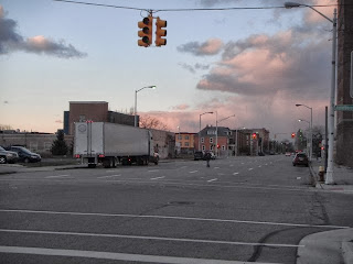
It may be unusual in almost any other urban area, but not the Motor City.  In due time, the city could end up removing this traffic light at the intersection of Peterboro Street and Second Avenue altogether.  It stands just a little over a mile from Campus Martius Park, this absolute center of downtown.  But why would the City’s Department of Public Works consider removing a traffic light in an area so close to highest concentration of jobs and workers?


It’s not rocket science.  This intersection no longer endures the volume of traffic to justify a stoplight.  Or, at least, the City is pretty sure it doesn’t.  Curbed Detroit featured an article on this assessment much earlier in the year.  In many regards, it’s not too surprising, given the hierarchical importance of these two streets.  Second Avenue would most likely qualify as a collector, an intermediate street that does not provide the length or support the volume of vehicles that a more prominent arterial would (such as Woodward Avenue).  Meanwhile, Peterboro Street is little more than a local road, just four blocks in length and not intended to handle any major traffic beyond access to residential quarters.  The Google Map below better demonstrates this relationship.


Detroiters know that Second Avenue is hardly a street on par with Woodward, just three blocks to the east; it terminates just a few blocks to the south, at Temple Street and Cass Park.  And Peterboro, the cross street, is only four blocks long.  Considering the built environment in the area today, its hard to conceive of a time when the density of commerce and vehicles was ever enough to warrant a stoplight here.  But, in many regards, that is the marvel of Detroit.  Here’s a clearer view of the intersection looking northward down Second.


One could make excuses for the general feeling of emptiness, considering that I took these pictures in the late afternoon on a Saturday.  But judging from the absence of major buildings flanking either side of Second Avenue, is there any reason to believe these lanes (all one-way northbound) are ever congested?


Historically, one of Americans’ favorite gripes about their respective cities is the snarling traffic problem, indicative of streets that no longer have the capacity to handle the vehicles that pass through.  However, even the pro-car stalwarts (and the Motor City has more than its share) would have to argue that Detroit’s roads suffer the opposite capacity issue.  Simply put, these streets don’t handle nearly the magnitude of traffic for which their designers originally anticipated and intended.


Both Michigan DOT and Southeast Michigan Council of Governments (SEMCOG) offer reports on Annual Average Daily Traffic (AADT) counts.  SEMCOG, with a smaller geographic focus, also seems to offer much greater detail in its AADT research.  For example, this table provides the AADT for Peterboro Street west of Second Avenue, part of the intersection featured in the above photographs.  At 380, the number doesn’t seem that high even without a comparative context.  After all, this is only a mile from the absolute center of Detroit, and much less from what would generally pass at Detroit’s downtown.  Compare it with the AADT of other street segments of this very minor street and its clear that only two intersections involving Peterboro can even expect 1,000 cars to pass by in a 24-hour period.


But it gets worse.  Compare this with an intersection between a collector and an arterial a quarter-mile closer to downtown, for example:


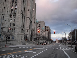
This photo looks eastward on Temple Street at the point where Second Avenue terminates, visible on the left, with the mammoth Masonic Temple immediately behind it.  Just in the distance are two more intersections with stoplights.  The purple circles in the map below indicate the locations of stoplights on Temple.


It amounts to one of the most excessive traffic light schemes I’ve seen in any major city center.  Because the two segments of Second Avenue are non-contiguous, they cannot share a stoplight.  However, in this instance, not only is the traffic volume insufficiently heavy to demand stoplights, but the flow of the traffic further weakens the need.  In the photo below, I’m standing between the two intersections (represented by the purple circles to the left and center on the map), looking eastward.


This stoplight regulates traffic on a segment of Second Avenue that is just one block long and only one-way northbound.  Thus, the light exists only for vehicles leaving Second Avenue onto Temple Street; cars along Temple can't do anything.  Why isn’t a stop sign sufficient?


The other intersection (the farthest purple circle on the left) is even more unnecessary.  


The stoplight directs traffic between Temple and Second, but yet again, Second is a one-way northbound street.  Thus, a stoplight exists only for vehicles leaving Temple to turn onto Second; no cars can legally travel the other direction.  Since westbound cars on Temple only need to turn right to enter onto Second, they would not need traffic regulation under any circumstances.  The stoplight only regulates cars turning left—no other purpose.  If these were high-traffic streets, some other form of management might be useful.  But remember what Second Avenue looks like:


Not just a yawning chasm of unused pavement, but a one-way yawning chasm.


I will concede that the Masonic Temple, as a performing arts venue and meeting space, can bring reasonable crowds when a show or indoor festival is in town.


But in a city with numerous magnificent theaters, the Masonic Temple doesn’t really dominate the scene.  It rarely hosts an event more than three nights a week, and while these can get crowded, does a street really need stoplights for just a few hours here and there?  After all, whether urban, suburban, or rural, one typically expects at least a little bit of traffic bottlenecking when a major show lets out.


I’m hardly an advocate for high-speed traffic flow as an easy remedy, especially in urban settings where numerous pedestrians could be present.  But the conditions for motorists along this stretch of Temple Street are almost comparable to waiting in line for a ride at Disneyworld.  Cars along Temple Street lurch only 100 feet from one stop light to the next, while waiting for absolutely nothing.  The lights aren’t timed to expedite flow, so it is common for a car to stop at all three intersections represented by the purple circles.  Worst of all: these lights are not under any study for removal…yet.


This predicament may seem minor in a city that has lost over two-thirds of its population since its peak (and is continuing to hemorrhage in most neighborhoods), but it is an inevitable consequence.  The lower east side of Detroit, home to some neighborhoods that have lost over 90% of the population from the 1950 peak, has none of these “removal” signs.  No decommissioned stoplights planned, although the condition of stopping at lights for no reason is ubiquitous on that side of town.


As a result, the fact that the Department of Public Works’ Traffic Engineering Division is assessing the possibility of removing traffic lights seems like lemonade out of lemons.  Not only is it good for people getting around by car in the Motor City, who won’t suffer the inefficiency of stopping at lights that no longer need to exist (a Pareto optimality under just about any argument that comes to mind).  The win-win resolution prescribed here may seem out-of-touch with the broader concerns of job loss and concentrated poverty, but any bankrupt city that needs to divest of some of its most fulsome assets (and their associated operational costs) will inevitably have to confront the phenomenon of traffic management in an environment that no longer handles much traffic.  Even if the City sells its tri-color portfolio to fast-growing metros that need them, it will probably only amount to a drop in the bucket when it comes to reducing some of the catastrophic debt.  But this strategy is both relatively easy to implement and unlikely to generate the sort of controversy that one might expect from, say, stripping the Detroit Institute of Art of its collection.  One final aspiration: that the Department devises a tactic so that a single “study for removal” doesn’t cost more than the value of the intersection’s stoplights themselves.