
The visibility of electrical infrastructure has become spatially polarized. It often appears that “modern” American subdivisions operate in a world without overhead wires. (The only wires typically straddle the edge of the neighborhood, along collector streets that allow entry to our wireless domestic enclaves.) The central cores of most cities—the historic downtowns—usually also enjoy sufficient density of electrical use to justify undergrounding. However, everything between the downtown and the suburbs of America’s historic cities—in short, the “inner city”—is replete with cables, wooden poles, and pylons. The concept of undergrounding scarcely existed at the time when these older urban neighborhoods were fashionable. By the 1970s, when undergrounding for new construction first became prevalent, the investment cost in burying wires in these mature communities hardly seemed worthwhile, since the middle class was fleeing them in droves. Now that the majority of Americans live in suburbs, one could argue that a preponderance of residential communities in which people live have underground cables, even though the overwhelming majority of land coverage—the inner city and the vast stretches of rural settlements—remain dependent on overhead wires.

The configuration of overhead electric systems in New Orleans, my featured city, hardly differs from most other places: the downtown and newest suburban subdivisions have them buried, while hardly anything else does. But the “undergrounded” portions of the city seem particularly small, and many areas that one would typically expect to feature buried cables remain triumphantly elevated a hundred feet above street level. Convention Center Boulevard stretches across the edge of the city’s Warehouse District, which rests fully within the boundaries of the Downtown Development District. Yet it has overhead cables of a magnitude and prominence that one would only expect to see along a major highway in the outlying metro area. Just look in either direction:


They’re huge. Intimidating, even—and taller than many of the three-story commercial buildings in the area.
But how do they rate as a logical means of circulating electricity throughout the region, considering the constraints imposed by the city’s climate? New Orleans struggles with its propensity to suffer powerful, hurricane induced winds. After all, Hurricane Katrina left over 80% of the city without power for months. One might think that either the Department of Public Works or the private utility providers would seek to underground more of the wires. But most of the city rests below sea level, and essentially all of it sits in a floodplain, making the buried wires equally susceptible to soil saturation. Any lawyerly investigator would naturally respond: “Cities in Holland, such as Amsterdam, found a way to bury the overhead wires, even though they sit below sea level. So why can’t New Orleans do it and help minimize power outages after major storms?” The simplest answer would be that Amsterdam—and all of the Netherlands—has installed a complex flood protection system that essentially shields them from the North Sea tidal surges, so that only a natural force once every 50,000 years is likely to cause flooding. In short, Amsterdam could enjoy buried cables because it has virtually eliminated the chances of water intrusion. When the Army Corps of Engineers’ upgrades to New Orleans’ levees and pumping stations are complete, the city should experience a 1% chance of flooding each year—an astronomically higher risk than Amsterdam. And this is the city’s aspiration in a post-Katrina landscape. Because of its subtropical latitude and proximity to the Gulf Coast, New Orleans will always be more susceptible to failure of its flood protection system: in fact, the sophistication of Holland’s system, if transferred to New Orleans, would still only be good for protecting in the type of flood that occurs once every 500 years. Hurricanes are fundamentally more violent than anything Holland will ever likely suffer, and the technological advancements to protect New Orleans at the same degree as Amsterdam simply do not exist, or they are permanently outside of any municipal, state, or federal budget.
Skeptical lawyers may raise their hands again: “Nearly all of New Orleans’ street poles parallel the sidewalk and the street curb, so the wires essentially criss-cross the street, and poles obstruct the view of houses. Why couldn’t the utility companies have originally laid the wires behind the homes in the back alleys, as they often have done in the old residential neighborhoods of other cities?” It’s a valid criticism. Just look at the pictures below:


Observe how these Victorian shotguns must get their electric lifeblood right below the gutterline, at the location of those quintessentially ornate New Orleans brackets:

This configuration is hardly unique to New Orleans; plenty of other old neighborhoods in American cities have utility poles in the front yards of the residents. But in many cases in New Orleans, the poles only line one side of the street, and homes on the other side receive their juice through a bundle of wires that leapfrog across the lanes, or radiate outward from a single pole that serves as a vertex for distributing the current.


That’s a lot of wires. Compare this to a city like Chicago, where many older neighborhoods still employ overhead wires, but they are carefully tucked behind the homes in the back alleys and are virtually inconspicuous when walking or driving along a local street. Take the 3300 Block of North Hoyne Avenue, in the Roscoe Village neighborhood of Chicago. A photographed street section looks like the image below, taken from Google Streetview:

Compared to a typical New Orleans residential street, this block in Chicago is bereft of overhead lines. But they have not been buried. Look slightly above and behind the homes on the left side of the street. The secret to Chicago’s comparatively inconspicuous overhead electrical grid is that it falls behind the homes, parallel to the back alleys. The back side of 3300 North Hoyne is visible below:

The wires radiate to each of the residential units from the central artery of cables hoisted by wooden poles, but their location in the back alley makes them barely conspicuous from the street out front—presumably the side in which most people would prefer showcasing their homes. No electrical poles blocking the façades either.
Chicago’s placement of the poles on nearly all of its streets is orderly, efficient, and subtle. But the city’s entire street network could claim two of those three adjectives as well. The relentless grid is orderly, efficient, and anything but subtle, as it is patently obvious to even the most uninformed viewer when flying overhead. Here is the network for Roscoe Village and its environs:

Chicago blocks are fundamentally rectangular based, or—one could argue—bisected squares. Homes front the long side of each quadrilateral, while the entrances to the alleys fit within the short side. Thus the alleys on the 3300 block of North Hoyne—and the power lines—fit into the block structure like this, as indicated by the red markings:

This grid replicates itself across the entire city, with few deviations—it is essentially an extension of the range and township line system originally platted from the Land Ordinance of 1785. Zoom out just a bit to see these bisected squares writ large.

While by some metrics, the grid is so repetitive that it makes navigation in Chicago more monotonous than it otherwise would be, it certainly makes it less difficult as well. It also facilitates the linearity of the overhead wire network in place in Roscoe Village and numerous other neighborhoods.
New Orleans by and large adheres to a grid network as well, but it is hardly as straightforward. One of the main reasons the city has earned the nickname “the Crescent City” is because of the concave bend in the Mississippi River which forms the basis for a continually reconfigured street network, visible in the map below:
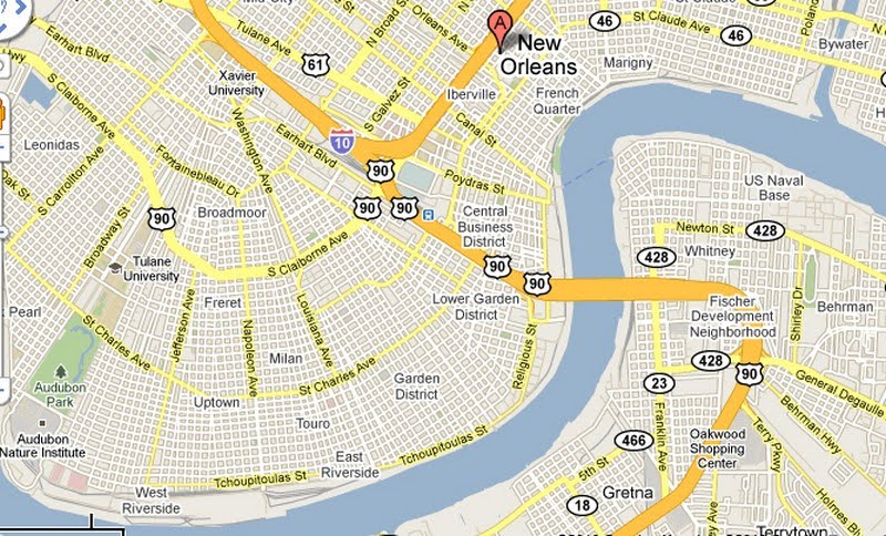
Gridlike it may be, but virtually no one would claim it is an easier city for navigation than Chicago. The network routinely re-orders itself based on the serpentine path of the Mississippi River to the south. Arterials like Claiborne Avenue and St. Charles Avenue parallel the sinuous curves but still operate as the closest thing to a direct route: thus, an unacquainted visitor may think he or she is going straight along these streets—and most cross streets run perpendicular to them—but, if one watches these streets up to the horizon line, they follow a subtle arc. The result encompasses a series of grids that radiate outward from an unarticulated in triangular portions, like the folds of an Asian fan. For navigational purposes, it is virtually impossible to travel north or east as the crow flies, and it is equally difficult to provide directions using the conventional language: instead of “north”, locals will usually say “upriver” or “downriver”.
Zooming into a New Orleans grid makes it clear how different it is from Chicago.

The fundamental geometry is a square, not (as in Chicago’s case) a rectangle or a bisected square. The two long sides of a Chicago rectangle offer the front-door access to the homes and the two short sides provide access to the alleys, garages, and concealed overhead wires. New Orleans’ blocks lack the frontage hierarchy of Chicago; they are more egalitarian, and all four sides of the square typically provide access to homes. If I stare down the length of a block—any block—in New Orleans, this is what I see.


Very few curb cuts, and no alleys. With the exception of a few select blocks in the oldest neighborhoods—The French Quarter, Warehouse District, and Faubourg Marigny—New Orleans is comparatively lacking in rear access to property the way an alley-dominated city like Chicago is. A further zoom-in to the Uptown neighborhood more clearly reveals the configuration of parcels and property lines within each block, and it’s hard to spot any real pattern.

I can only begin to speculate exactly why New Orleans has such an irregular block system, but it largely echoes the anything-goes approach toward housing development that New Orleans has long adopted. As I walked along about eight blocks in this generally upper-middle class section of Uptown, I could witness a far greater diversity of housing types than one would expect in a similarly sized neighborhood in Chicago. As the two home photos above demonstrate, it’s interesting to see where homeowners decide to place their cars when they typically lack garages or carriage houses out back. Homes aren’t spaced as close together as they often are in Chicago, so some people squeeze a driveway to the side of the lot.


Others simply convert their modest front yards to parking spaces:

Still others preserve the fringe of greenery and settle for parking in the street.

My investigation as to why New Orleans lacks alleys has figuratively backed me into dead-end one—I can’t find any real answers. But I can guess. Unlike Chicago, in which large tracts were platted and developed with parcels of equal size and housing catering largely to a single economic group, New Orleans’ neighborhoods are a pastiche of irregular lot sizes, homes of widely variable scale and quality, and a seemingly arbitrary mix of uses. The result is—and has always been—that the wealthy and poor more frequently live cheek-by-jowl than in most other American cities. (It could also explain why New Orleans appears to be among the less broadly segregated cities in terms of housing and race.) Many wealthy old families from Uptown wanted their slaves (ahem—servants) to live in close proximity, if not on the premises. Instead of an alley and a garage, the back sides of many homes feature a smaller, semi-detached unit that once served slaves’ quarters. The resulting arrangement of parcels in blocks makes it nearly impossible to draw straight lines across parcel boundaries in New Orleans, and particularly hard to limn a dedicated utility easement behind the properties. The agency installing the poles and wires would have to zigzag out of different parcel lines in order to furnish an electric network in the back yards of people’s houses. Thus, the city’s leadership decided long ago to install virtually all of its electric poles in the only place where straight lines where relatively feasible—in the front, right along the sidewalk.
New Orleans faces a twofold dilemma, or four-fold, since all dilemmas have a duality to them. It would be wise to bury the cables to protect them from the strong winds of hurricanes, but then they’d be that much more vulnerable to inundation from floods. It would be lovely to conceal them in the alleys like Chicago does, but by and large it does not have alleys. The City most likely can never aspire to remove the overhead clutter in most of the old urban neighborhoods. How, then, can it come to terms with the mass of exposed infrastructure that comprises a typical street scene? The answer is simple: foster a culture around it that nullifies the idea that it is ugly, messy, or archaic. Celebrate it.
In the third and final section, I will focus on the most cost effective solutions for dealing with the visual pollution of infrastructure, using New Orleans as a model and revealing that it has far less of a hurdle to jump than it may initially seem.


0 comments:
Post a Comment