Monday, March 25, 2013

Vesuvius erupts in the prairie.


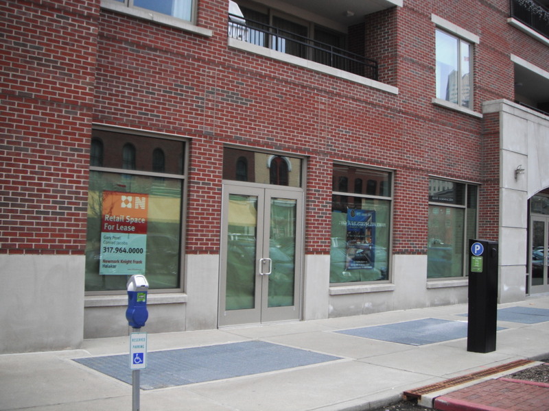
In the world’s most overbuilt nation for retail space, any outside influence can induce an infinitesimal change that nonetheless completely transforms the landscape for commerce.  The retailers who continue to succeed in this economy—particularly impressive given the growing portent of online shopping’s eventual dominance—help shed light on what type of structures/milieus they are seeking to house the goods that they sell.  White-collar workers are broadly familiar with the Class A/B/C ranking of office space, but what if we applied this system to retail?  My suspicion is that, based on occupancy levels and the tenant mix, the average American metro area has about 10% at class A, 40% at class B, and a whopping 50% at Class C—the low-end structures that desperately snatch up any tenant they can get.  In relation to the demand, the supply of retail in this country is outrageous, and there’s no sign of this supply flagging, since developers continue to build new strip malls on raw land.

At any rate, retailers enjoy the privilege of calling the shots in a national market that suffers from this plethora of supply.  And it allows for an anthropological study of commercial epochs, by exhuming the remains from within shopping sarcophagi from yesteryear.  Take this one, for example:
 
The name “Venture” and its black-and-white logo are unlikely to be familiar to anyone outside of the Lower Midwest, or anyone who has not yet graduated high school.  But for the rest of us, it was a prominent name in the mid-1990s.  Based out of O’Fallon, Missouri (a suburb of St. Louis), Venture was a discount all-purpose store trying to gain a national foothold at the same time that Wal-Marts and Targets were proliferating wildly.  Needless to say, Venture lost to those two giants and filed Chapter 11 bankruptcy in early 1998, then closed all its stores later that year.

My memory of Venture depends on its fiercely confident advertising campaign launched on Indianapolis a few years prior; I can still remember the jingle to the radio/TV commercials.  While it positioned itself as the new challenger to Target (much more than Wal-Mart), I never got the feeling it inspired a lot of confidence.  I’m pretty certain it choked in Indy a few years before it folded completely.  If it survived even four years in my hometown’s market, I’d be surprised.

The sign from the above photo comes from an old shopping center in Fairmont City, Illinois, a small, incorporated stretch of land between two larger and more prominent St. Louis suburbs of East St. Louis and Collinsville.  By this point, many Americans know of the formidable struggles East St. Louis has endured over the years.  Burgeoning in population through industrial and railroad growth after the Civil War, the city achieved its population peak (like so many in the Rust Belt) of 82,000 at around 1950.  It even earned All-American City recognition in 1959.  But de-industrialization and the diminishing importance of freight rail hit the city hard, instigating a precipitous population loss that continues to this day.

As of 2010, the city had 27,000 inhabitants—less than 1/3 its rate from sixty years prior.  Racial tensions undoubtedly amplified problems in East St. Louis; the city suffered a serious racially motivated riot in 1917.  In the ensuing decades, the white flight that took place in older industrial cities across the country across the country managed to culminate in the almost complete desertion of East St. Louis, which today this day is nearly 98% black.  Needless to say, people of all races with enough wherewithal have striven to get out of East St. Louis for quite some time.  It typically ranks near the top small cities in America for percentage of population in poverty.  As is typically the case, these people evacuating East St. Louis, few of whom have a great deal of assets to begin with (housing equity in ESL is next to nothing), quite logically move to the next tranche of housing affordability, which are typically the (slightly) more economically healthy communities nearby.  The migration pattern around East Saint Louis is obvious: abutting municipalities such as Washington Park, Centreville, and Cahokia now suffer similar conditions.  These three communities, originally early 20th century bedroom communities that swelled from the white flight after 1950, now have profiles similar to the core city from where the flight began: poverty is above 20% in each, and the African American population ranges from 55% to 95% (despite the fact that St. Clair County as a whole is only 29% black).  Those with more continue to flee from those with less.

The aforementioned village of Fairmont City also sits in close proximity to East Saint Louis, but its ethnic shift falls under different contours.  Originally settled by Central European immigrants, the non-Hispanic white population plunged asLatino settlers moved in, pushing the Hispanic population above 55%.  Fairmont City’s population hasn’t dropped like the other communities listed; in fact, it grew from about 2400 to 2600 over the last ten years.  But the newcomers, often non-English speaking, lack the same purchasing power as their long established white predecessors.  How does this shape the commercial landscape?
It’s not so much that Venture went out of business in 1998; it’s that nothing has come to replace it, or at least nothing with enough capital and staying power to justify removing that sign with the old logo.  A cruddy photograph below suggests that the shopping center might still claim some marginal tenants:
Unfortunately, I didn’t think to get a good image of the store as I zipped by, but it appears that it still might host (or has recently hosted) some sort of showroom for racing cars.  But it’s obviously not an establishment with enough capital to replace the “Venture” sign along the road, and it doesn’t appear the owners could conceal all of the old logo on the sign attached to the building.  Perhaps it didn’t matter enough: the checkered flag and the diagonal stripes still use the same black-and-white motif.

For Fairmont City, with a poverty rate now hovering around 15%, economic disinvestment has induced retail stagnancy, forcing a chronological deep freeze on basic advertising and signage.  Or, to use the metaphor in this essay’s title, a volcano suddenly erupted and halted economic advancement in its tracks.  Apparently as recently as 1995—when Venture stores were at their peak—the Fairmount City area could economically support this competitor of Target.  Not anymore.  The middle class fled that quickly.  This aging big box may eventually find a new tenant, though the demographic shift doesn’t suggest that a widely known national chain is itching to move in.  But it could be just the right size—and location—for a supermercado.

Thursday, March 21, 2013

Vitality behind venetian blinds.

My most recent post just went up on Urban Indy.  It is essentially an assessment of the Mass Ave retail corridor near downtown Indianapolis.  By most respects, it's a lively, active urban corridor, attracting yuppies, guppies, buppies, empty nesters, DINKs, you name it--a contemporary spontaneous street ballet of conspicuous consumption.  It has great old architecture, a few thriving little public spaces, a certain added texture created by the imposition of a diagonal street on a vertical built environment, and a walkable landscape.  At its best, it makes Indianapolis feel like a bustling big city--which at times it can be.

But Massachusetts Avenue isn't quite as flourishing as it could be.


Vacancies often remain that way far longer than you'd expect for such a trendy area.  Some of the newest construction, like Trail Side on Mass, has yet to secure a single tenant among its extensive first-floor retail.  But that might not be the biggest indicator.


A considerable amount of Mass Ave's first floor storefront space features insurance agencies, realtors, engineering firms, orthodontists.  Absolutely nothing wrong with these tenants, but do they really need to take prime retail space?  Apparently not: the majority of them keep their blinds closed even during daylight hours.  They could easily take the upper levels in a high-rise office building, or even the second floor of these traditional commercial buildings.  But they don't.  And the overall retail scene on Mass Ave suffers as a result, particularly at night, when bars and restaurants alternate with these forlorn storefronts.

In the full-length article, I explore the conditions endemic to Mass Ave that would explain why so much of the retail consists of tenants such as these.  I would never venture to suggest that they shouldn't be there--obviously the landlords need to lease their space, and chiropractors have as much right to the a big storefront as anyone else.  But their prevalence suggests that this corridor falls far short of the demand it should offer, and the article explores how development should continue along the Avenue to drive up demand that lures premier tenants to what should be Indy's most thriving commercial main street.

Sunday, March 17, 2013

If a mall implodes in a small town, is anyone there to hear it--or to care?

I’ve documented evolving retail trends with a keen eye over the past few years.  Regardless of the size of the community, certain similar features have emerged that very well may augur a monumental shift in typology, akin to what transpired in the 1950s and 60s when pedestrian-scaled downtowns lost all their commerce to suburban strip malls and shopping malls catering to the automobile.  This time, the loser is exactly what previously vanquished the downtown: the enclosed shopping mall.


It doesn’t take a rocket scientist (or even an entry-level associate at Simon Property Group) to conclude that the era of the mall is over.  Sure, plenty of malls out there are still thriving, but you’d be hard pressed to find one person in this country who cannot think of a mall that is dying, or is already completely dead.  The last mall built in the US was The Mall at Turtle Creek in Jonesboro, Arkansas, in 2006.  (Incidentally, it was the second mall to open in the Jonesboro metropolitan area; the older mall, Indian Mall—serving the community since 1967—promptly lost nearly all of its tenants, and quickly died.  Demolition crews took down everything except the still operating Sears in 2012.) While Simon (among others) proposed some malls in the latter part of the decade, all deals collapsed at the onset of the 2008 recession.  Not a single mall has broken ground in seven years.  As recently as the early 1990s, a new mall opened somewhere in the country at least every month—in the 80s, they opened practically every week.   Not only is the mall no longer the dominant hub for retail in large metro areas, it has lost out in the smaller ones as well.


I noticed this shift—already widely documented throughout major cities—in the small metropolitan area of Houma, Louisiana, where pocket neighborhood shopping districts (scattered throughout the city) and the moderately sized Southland Mall were losing out steadily to a throng of big-box stores, all lined up in a row along one of the biggest highways in town.  It seemed like residents of Houma were more than willing to drive greater distances to run the gauntlet of traffic around the superstores, rather than enjoy the convenience of a smaller retail plaza close to home.  Today, those neighborhood strip malls, close to most of the housing, generally share high levels of vacancy and disrepair.  Meanwhile, the Southland Mall clings to life, its occupancy rate at around 60%, well below the level indicative of a healthy commercial landscape.


Now, apparently, the enclosed shopping mall even struggles in municipalities so small that it’s hard to spot the competition.


The above photo depicts the Village Square Mall in Effingham, a community with a little over 12,000 inhabitants in south-central Illinois.  Truth be told, the economic conditions in Effingham are not hugely different from Houma: the regional economy has weathered significant ups and downs over the last few decades, but the population of the municipalities themselves has remained mostly stable.  Both municipalities are regional employment hubs, offering both jobs and retail offerings that serve a broader spatial area than their populations would suggest.  And in both cases, the downtowns show some evidence of revitalization, featuring locally run shops and restaurants in refurbished older buildings.  Effingham has only about one-third of the population of Houma, though, and it boasts one significant advantage: it sits at the convergence of two major thoroughfares, Interstate 70 (connecting St. Louis to Terre Haute, and eventually Indianapolis) and Interstate 57 (connecting Chicago and Champaign eventually toward Memphis).
 
No doubt this geographic blessing helped the city christen itself as “the Crossroads of Opportunity” and emboldened it to earn the status of a Micropolitan Area by the US Census Bureau, indicating that it attracts commuters well outside its city limits, much the way a metropolitan area does—except that Effingham is not populous enough to classify as a metropolitan area.  However, its centrality and influence span the entirety of Effingham County, which contains a population of 34,000 people—almost identical to the city limits of Houma. 


Thanks to these two interstates, Effingham may be preferred stop for travelers coming lengthwise across Illinois, or for those seeking a pit stop between St. Louis and Indianapolis.  In case the long-distance traveler wasn’t aware of Effingham’s regional significance, the local Cross Foundation helped erect a 198-foot steel cross structure on the outskirts of the city limits, broadly visible from a distance and dedicated just days after the September 11, 2011 attacks.


It is the region’s biggest attraction.  And, surrounding the cross in almost every direction is a none-too-surprising industry.  Unfortunately, I didn’t get any good photos, but Google Streetview offers a perfectly good representation, both here and a bit further to the north. It should come as no surprise that Effingham boasts a flourishing logistics and trucking industry, no doubt providing the city with tax revenue that explains its well-paved streets, abundant sidewalks and jogging paths, and a well-maintained downtown.


But nowhere along the I-70 or I-57 corridors does a motorist encounter a sign for the Village Square Mall.  Taking another look at it, it’s easy to see why it gets neglected.  The photos at the top of this essay actually showed the good wing of the mall, with a still operational J.C. Penney.  But what about the other wing?  Pivoting to the left, this is what one would see:


And then a bit further to the left:


A pretty bleak scene.  It was never a large mall; it probably only has space for 25 inline tenants.  But that parking lot can sure accommodate a lot of cars.


As for the interior, it offers about what one might expect, given the abundance of cars milling around out front.


I was pretty taken by the tenant at the other long-vacant anchor store (opposite the J.C. Penney):


Obviously I’m giving away the time period that I visited the mall, but I have never seen a haunted house in a mall’s dead space before.  Essentially, haunted houses such as these operate in much the same fashion any other holiday-themed pop-up store, viable only a few weeks before Halloween.  Then, no doubt, the large retail space returned to its usual vacancy.  Here’s the outside view:


A neglected mall such as Village Square would probably suffer serious vandalism if it were in a more high-crime area.  Effingham doesn’t strike me as that sort of place; so instead, the low levels of security and supervision elicit some amiable eccentricity:


I was about halfway through writing this essay when I learned that the well-known site Labelscar had already covered this tiny mall a couple years ago.  Now I’m trying to find ways to distinguish my essay from the one on there.  That site offers a broader array of interior photos, though they’re older, and our primary observation/argument is just about the same: Village Square Mall has endured a steady decline over many years.  The writer for Labelscar claims that a series of non-local property managers showed persistent ineptitude in operating the mall and attracting tenants, and I wouldn’t doubt it.  But the general patterns of development around Effingham are what really stacked the deck against the Village Square Mall.


The map above perfectly demonstrates the problem.  The blue rectangle south of central Effingham shows the general location of the Village Square Mall parcel.  It’s not far from downtown (in Effingham, everything’s close), but notice that the majority of the street grid and development has occurred in a northerly direction.  In addition, the double-barreled interstate I-70/57 wraps around the northern and western city limits—far from the south.  Even if the Village Square Mall were worthy of promotion along the interstate, no amount of signage would make it a convenient destination after getting off the exit ramp.


The map above also reveals what has most likely lead to the mall’s virtual demise.  A purple ellipse on the northwest side of town shows the new retail hub for Effingham, right where busy State Route 33 meets I-57/70 at the exit ramp.  I neglected to photograph the retail at the “Avenue of Mid-America”, but once again Google Streetview comes to the rescue here and a bit to the east, but still in that general location.   You’ve got the usual suspects for shopping and dining: Wal-Mart, Ruby Tuesday, Menards, Arby’s, Starbucks, T.G.I. Friday’s, Cracker Barrel, and a slew of hotels catering to all price ranges.  To the north, sitting amidst an undeveloped field in Effingham’s “frontier”, is a Kohl’s.  Given the persistent success of this supremely well-run company, this land will undoubtedly morph into further big-box retail in the near future, if it hasn’t already (the Google Streetview dates from 2008).


No surprises there.  Much like Houma, the preferred retail hub for Effingham has become even more decentralized than before, lined up along a busy highway that maximizes visibility to the thousands of outsiders who pass through this town on any given day, thanks to those two interstates.  This migration is hardly earth-shattering.  What leaves me scratching my head is the original inspiration for the location of the Village Square Mall.  Why put it to the south?  Was there ever a point when that seemed to be the growing side of town?  If, as Labelscar claims, the mall opened in 1972 through the initiative of a local developer, why didn’t he investigate the construction plans for the interstates?  By the early 1970s, huge portions of these interstates were already complete, and it is likely that the Effington “wraparound” was fully designed, if not already operative.  Did he just have his sights on what most likely has always been the cheaper land?


It’s possible that Village Square would have declined even if it had been front and center along the interstate.  After all, plenty of other malls have sat a stone’s throw from a major highway and croaked in spite of everything; I chronicled the well-known Bannister Mall in Kansas City a few months ago. Not a trace of the Bannister Mall remains, even though I-435 runs immediately to the west.  But Effingham has another peer city in much closer proximity than Houma: Mount Vernon, Illinois, just 70 miles to the south.  I don’t know much about Mount Vernon, except that it, too, sits at the junction of two interstates (I-57 and I-64), has a similar population (15,000), and claims a similarly sized retail hub: the Times Square Mall.  Most online buzz suggests, however, that the Times Square Mall is in much better shape, with three fully operational anchors (Sears, Peebles, J.C. Penney).  It even has a website!  Times Square Mall can claim these victories, despite the fact that Mount Vernon shows evidence of lower economic health than Effingham: it has a higher poverty rate and more notable population loss over the past decade.  But…the Times Square Mall sits just a quarter mile from the busy I-57/64 interstate (probably visible to passers-by), and its on the west side of town—the same direction in which the town’s urbanization seems to be advancing.


I wouldn’t be surprised if Effinghamians go south to Mount Vernon to shop; certainly not the other way around.  Perhaps the Village Square Mall has succumbed to the retail tsunami sweeping America, or it could be something simpler: location, location, location.  The original developer opted for cheap land rather than good land, and though it has taken forty years, eventually the time has come to pay the devil his due.

Thursday, March 14, 2013

The right kind of sidewalk clutter.

My latest post--a short one (for me at least)--is now up at Urban Indy.  It focuses on the Mozzo, a newly completed multifamily residential development in the Sacred Heart neighborhood, fronting the increasingly active Virginia Avenue commercial corridor.


By and large it's a satisfactory building, with a massing that befits the old neighborhood just a mile southeast of Indy's Monument Circle.  While in the long run, I wish it had more retail, the fact remains that the density downtown is probably not yet there to support it--several other recently completed developments have also struggled to find first-floor retail tenants.

My focus, however, is on the one 1,700 sf pocket of retail in the corner of the Mozzo's first floor.
 
It does not yet have a tenant, but the promotional screen in the window claims to offer outdoor seating.  After looking around the area, I can only help but ask, "How?"  The sidewalk to the left of the above photo (fronting local road Merrill Street) is conventional width for this neighborhood, and has a big utility pole sticking out of it.  The sidewalk to the right in that photo is the much more generous Cultural Trail, hosting both a pedestrian and bicycle component.  Generous as it may be, the Cultural Trail is not wide in order to host cafe-style seating.  The sign in the window is misleading, and my blog explores the broader implications of what this is saying about private sector perceptions of public space embodied by the Cultural Trail.  Comments as always are welcome.

Monday, March 11, 2013

Buckeye boundary balderdash.

Here’s a rarity for me: plunging right into the photographs, with nary an introduction.  I don’t think it’s necessary this time.


A few months ago, I was leaving Cleveland, Ohio on Interstate 71, headed southwestward toward Columbus. 


(Yes, that VW Beetle in front of me really is missing its rear windshield, in 25 degree weather.)  While driving on the freeway, I spotted some unusual signage along the side of the road.  At one point, between mile marker 244 and 245, a sign indicated that I was leaving Cleveland city limits and entering a suburb called Brooklyn.


Nothing too remarkable there; I was crossing municipal line.  However, I only had to continue driving for a few seconds before I saw another sign.


Returning to the corporate boundaries of Cleveland.  Either Brooklyn, Ohio is that tiny of a municipality, or I just skirted the very edge of it.  It turns out neither is the case.  Another few seconds later (going slowly along the shoulder of the highway), and a new sign:
Back to Brooklyn.  But this time the duration seems to be even shorter.  The photo below shows the same sign as the above photograph, only proceeding a little bit further down I-71.

This time, the next municipal boundary sign is plainly visible, in the photo just to the right of the speed limit sign and a little further down the road.  So, standing at this point, one could lob a football from the City of Cleveland, let it soar across Brooklyn, then cross the line again only to land in the Cleveland end zone.  Put a receiver at the latest Cleveland boundary and it might make a good practice strategy for the Browns offense.  Here is the previous “Cleveland corp limit” sign, as the motorist is passing it once more.


But it’s not over. This time the duration is a bit longer, but still less than a quarter of a mile down the road, we cross into Brooklyn yet again.


That makes a whopping five municipal boundary crossings between Cleveland and Brooklyn over the course of, at most, one half of a mile.  What’s going on here?  The map below should come as no surprise:


I have circled the area featured in the above photos in blue, and the Cleveland municipal boundaries are highlighted with a dashed line and pink transparency.  As the map indicates, Cleveland in this section has what one might call a “sawtooth” boundary, and, at least at this specific stretch of I-71 (known here as the Medina Freeway), anything that is not the City of Cleveland is the City of Brooklyn.  The freeway cuts across this boundary at one of its most irregular locations, and, in order to maintain the integrity of these actual municipal limits, these signs stand at every change—with a separate set of signs on the opposite side of this wide freeway.  That makes for ten signs.


Not surprisingly, I wasn’t the first to notice this idiosyncrasy.  A friend had already pointed it out to me, before I decided to chronicle it photographically during a most recent visit.  And John Horton, a reporter for the Plain-Dealer, noticed it two years ago.  Apparently at that point, the Ohio DOT had just installed them, rectifying a decades-long oversight, because the state’s traffic manual requires the installation of a municipal marker whenever a route crosses into new incorporated boundaries.  The estimated cost for a sign is $273.63, most likely putting the total installation cost, when factoring in labor, at well over $3,000.


While I don’t know a great deal about the nuances of publicly funded signage along interstate highways, I don’t really need to.  I can tell that majority of navigational indicators along roadsides are electives; individual States decide what they would like to include.  For example, Indiana nearly always features a sign indicating the name of a road (no matter how minor) that passes either over or under a limited access highway; Ohio does not.  Conversely, Ohio usually indicates to the motorist when he or she has entered a new incorporated area, but not Indiana.


Ohio statutes mandate signage every time a limited access highway passes through a new municipality, even if the freeway provides no exit ramps for a motorist to access the municipality, as is the case in each of these segments of I-71 that pass through Brooklyn. Such an initiative casts the appropriate stewardship of taxpayer dollars into serious doubt.  Is it really necessary for motorists to know each and every time the highway traverses the Brooklyn/Cleveland boundary?  Based on Horton’s reporting, the two communities find those signs critical in determining which municipal police force will need to respond to various calls.  But a lawyer conducting thorough cross-examination would not content him or herself with that answer.  Don’t most emergency response vehicles these days have sophisticated enough GPS to render these signs obsolete?  Let the lawyer cross-examine the fictitious witness about the larger issue at hand: what impelled the two municipalities to share such an irregular border in the first place?  According to Horton, once again, the original boundary made perfect sense: a body of water called the Big Creek formed a logical demarcation.  However, during the construction of Interstate 71 in the 1960s, the State relocated the creek, allowing a clean trajectory for the new roadway…but no one bothered to reconsider or reconfigure the odd (and now inexplicable) shape of the municipal boundaries.


Over the years, I have referenced other similar instances of municipalities attaching what one might call a disproportionate amount of importance to their boundaries.  Incidentally, several situations that I have recognized have taken place in Ohio, a heavily urbanized state with a statutory culture that does not mandate incorporation (in contrast with neighboring Pennsylvania and most of the states of the northeast, which are nearly 100% incorporated).  Ohio offers such extreme contrasts between its industrialized urban centers and agrarian flatlands—the Rust Belt around Lake Erie and the Appalachia in the southeast—it apparently doesn’t take much for an agglomeration of houses to organize itself as an incorporated municipality.  Not surprisingly, a home-rule culture often pervades in municipalities both large and small, with each seeking to distinguish itself from another.  I referenced one example—also in metro Cleveland—where a single road had different speed limits, depending on which direction a motorists was traveling, due to the fact that a municipal boundary split the crown of the road across two towns, each of which passed distinct speed limit laws.


Speed limits may seem like highly fungible context from which to observe municipal megalomania, but they’re effective because they hit many people close to home.  Viewing the Cleveland/Brooklyn boundary signs again, one can notice that speed limit signs accompany a few of them.  That’s right: cars may be forced to accelerate or decelerate to accommodate shifting speed limit regulations between Cleveland and Brooklyn.  But apparently that isn’t the worst of it.  Just a half mile to the east along the Medina Freeway, motorists will confront yet another municipal boundary: entering the tiny village of Linndale.  Unfortunately, I was unable to capture the predictably unremarkable sign, but Google Streetview offers a good enough representation.  Outlined in purple, to the west of the blue circle, are the general boundaries of Linndale.

At only .08 square miles and a little over 100 people, Linndale’s most distinctive feature is the 200-yard stretch of I-71 that bisects it completely.  As a fairly recent issue of Cleveland Magazine recalls, the municipality lost half its population when the DOT tore the homes down to make room for the freeway.  Despite what most would see as an incorrigible setback, Linndale has supported itself quite comfortably over the ensuing decades.  How?  You probably guessed it already: it’s a notorious speed trap, earning approximately 80% of its $1 million municipal budget (a very generous budget for a town of its size) through citations.  The Village has aggressively and successfully defended its legal right to enforce the 60 mph speed limit of this segment of I-71 in courtrooms, using the Home Rule provisions of the Ohio constitution to justify its four full-time and ten part-time police officers.  Locals know that for the 20 seconds or so that it takes to drive through Linndale on I-71, they cannot be complacent behind the wheel.  But then—with a sigh of relief—they return to comparatively unregulated Cleveland, thanks to the greeting of yet another municipal sign.


Although Linndale currently appears to thrive, its leaders may need to read yet another of my blog articles, to serve as a caveat of what could happen if a subsequent court finds the village’s leadership is abusing its power.  East Cleveland, a much larger nearby suburb, has copious signage warning motorists using all city arterial, collector, and local roads that the consequences for speeding are steep; tickets are more or less the only way the impoverished community has of funding basic services.  Meanwhile, metro Columbus offers a scenario that could augur Linndale’s fate if it isn’t careful: the tiny village of New Rome claimed a stretch of US Highway 40 on Columbus’s near west side, which it monitored fiercely as a speed trap to the point of corruption.  State Auditor investigations provided inconclusive evidence that this village had ever even had a mayor in the last thirty years, or that it offered any real services to the constituents, aside from citing speeding vehicles passing through.  In 2004, a State judge ruled that New Rome (with a population hovering between 60 and 115) had showed persistent inability to govern itself through the transparent provision of actual city services, and the judge effectively dissolved the village into Prairie Township of Franklin County, Ohio.  New Rome no longer exists.


Municipal incorporations no doubt reinforce widely embraced American values of self-determination, but Ohio isn’t alone in revealing how the practice, when taken to an extreme, turns these fractured fiefdoms into crucibles of dysfunction.  Cuyahoga County, Ohio’s most populous county (despite decades of population loss), contains nearly 40 cities and 30 municipalities, yet only a handful of them gained population between the 2000 and 2010 Census.  (Incidentally, Linndale was among the fastest growing, leading some to speculate if the Village unreasonably enforced US Census bureau self-reporting to boost population, in order to justify its survival after the New Rome debacle.)  No individual municipality, not even the mother ship Cleveland, can necessarily claim responsibility for the post-industrial stagnancy that has afflicted the region for decades.  But piecing together 70 municipal governments calls into question whether the benefits of self-determination outweigh the costs of unnecessary, redundant public services, or internecine squabbles between two adjacent towns that cannot put their differences aside, sometimes over matters as petty as the speed limit on a shared street.


Cuyahoga County may not be flourishing if, as some have proposed, the majority of these municipalities consolidated into a significantly smaller number of city governments, as Metro Louisville did in 2003, merging the city’s borders with Jefferson County.  But the dialogue considering such a radical change is escalating in frequency and intensity, as more people voice their frustrations toward superfluous signage at the Brooklyn line…or the ridiculous speed limit enforcement in tiny Linndale, the most well-policed community in the county.  Framing the debate into an ultimatum between autonomy and efficiency results in an undeniable oversimplification of the issues at hand, but it’s no less factitious or loopy than the bizarre boundary between Brooklyn and Cleveland.

Wednesday, March 6, 2013

BOOK REVIEW: What Killed Downtown?


My latest is a first for me as a blogger: a book review.  The full-length review is now available at Urbanophile and should be accessible soon via other online outlets; I will update this blog post accordingly.  The book, Michael Tolle’s Who Killed Downtown? Norristown, Pennsylvania from Main Street to the Malls distinguishes itself through its unflagging focus on the six-block commercial center of Norristown, an older suburban community outside Philadelphia of approximately 30,000 people, of which most people in the country (let along in Pennsylvania) probably know little.  Although it emerged as a distant Philadelphia outpost in the early 19th century, and it remains the seat of government for Montgomery County, the Borough of Norristown is no longer a major commercial or employment center.

Most of the factors that influenced Main Street Norristown’s precipitous decline from its 1950 are predictable: overwhelming population growth to the south, the increasing dominance of the car along the city’s pedestrian-scaled street, the construction of limited access highways that threaded their way near Norristown but outside its boundaries; the proliferation of suburban shopping centers with free, ample parking for those cars.  Today, Norristown isn’t necessarily impoverished, but its income levels are significantly lower than all the communities that surround it, and far below the average for Montgomery County, one of the 100 wealthiest counties in the country.  And Norristown’s main street is a wraith: bereft of any major retail establishments, and pockmarked with parking lots where proud commercial buildings once stood.


With such an unwavering focus on six commercial blocks across 250 pages, how does Tolle distinguish his chronicle of main street decline from dozens of other similar books?  His biggest achievement, as far as I’m concerned, is a shrewd avoidance of socioeconomic variables to demonstrate his point.  He rarely touches upon reports for the US Census Bureau or the Bureau of Labor Statistics.  Instead, he integrates his study with numerous references to the City Directory of Businesses (comparing the change in industries every few years), articles from the Norristown Times Herald, advertisements (including misspellings and solecisms), and, in the later years, eyewitness accounts.  The worm’s-eye-view is unapologetically subjective, but this fundamentally anthropological approach lends the entire study a human interest that compensates for Tolle’s relentless fixation on storefront details.

I have my doubts that such a book will ever win much of an audience outside of Norristown and its purlieus, but if that’s enough for Tolle, I can certainly commend his refreshing approach to well-worn territory.  Comments as always are welcome; I will do my best to respond on this website, Urbanophile, or other outlets as they materialize.

Saturday, March 2, 2013

Browser band-aids.

It has been reported to me now by several sources that some people are having a difficulty reading my blog.  The two problems I hear about most frequently are 1) the text itself is missing from under the titles to each article; 2) the relevant links on the right-hand column don't appear.  Virtually everyone who has approached me with this problem has been using Microsoft Internet Explorer, a browser which currently isn't available to me on the MacBook Pro that I use most of the time.

I am investigating this problem; it seems I'm not the only one using Blogger that has issues with IE browser legibility.  During the time while I am addressing this problem, American Dirt may be offline for a day or two.  As always, I appreciate everyone's comments and feedback and look forward to more in the future--hopefully on a fully-functional blog.  Thanks again.